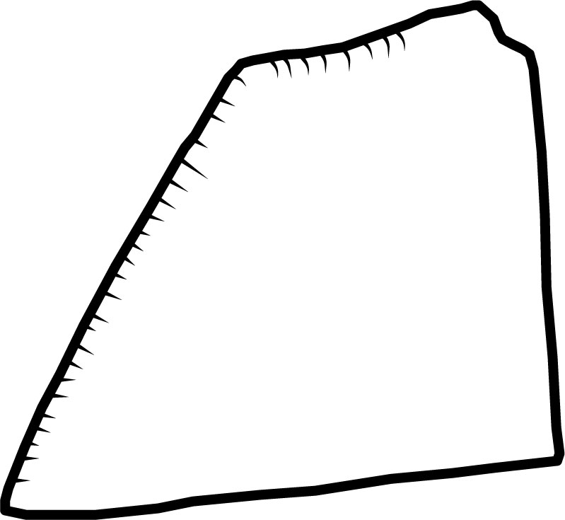
sol0002
- Site nameSolutré
- LocationSolutré-Pouilly
- CountryFrance
- Longitude4.725000
- Latitude46.296667
- Techno-complexAurignacien
- Layer
- Dating methodC14
- Dating34010±610 - 29020±170
- Excavation year
- Materiallimestone
- Object typeplaquette
- Size in milimeter (length x width x depth)95.0 x 70.0 x not available
- Preservationfragmented
- ReferencesFloss H. et al. 2013
Combier J. &
Montet-White A. 2002: p.259 fig. 19-12B - Sign Types
- line:
- notch: X
- v:
- obline:
- obnotch:
- dot:
- radline:
- radnotch:
- star:
- dashline:
- circumnotch:
- grid:
- circumline:
- cupule:
- paw:
- concenline:
- rhombus:
- vulva:
- pinleft:
- hatching:
- cross:
- pinright:
- rectangle:
- hashtag:
- zigzag:
- maccaroni:
- zoomorph:
- zigzagrow:
- circumspiral:
- anthropomorph:
- other: